
Mission Trails Regional Park
Most San Diegans at least know of Mission Trails Regional Park, that big open space up off the 15 and 52 freeways between the city and Santee. It’s the largest urban natural area in the state, encompassing some 8,000 acres of native chaparral and winding valleys, some of it relatively untouched since the days of the Friars.
With about 60 miles of trails, it hosts both natural areas and developed recreation opportunities for visitors of all ages and abilities. Its most imposing features, naturally, are the five mountain peaks within its borders, scattered on either side of the San Diego River. These five peaks have become famous for the Mission Trails Five Peak Challenge.

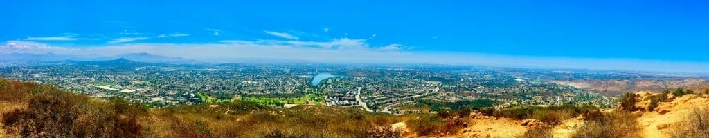
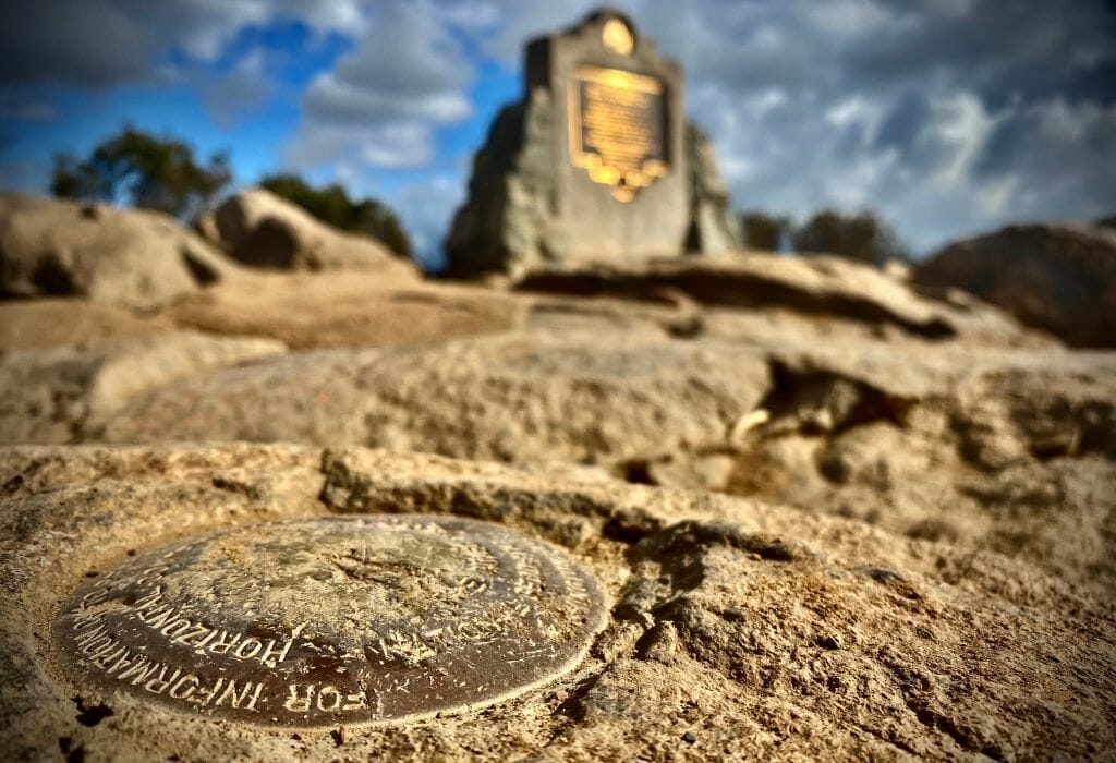
These mountains range in height from just over 1,000 to nearly 1,600 feet above sea level, and each offers unique, sweeping panoramas of the city and its environs. Well-marked trails lead to each peak, where climbers find historic markers to prove their accomplishments.
Despite their designation as mountains, the trails up are generally very friendly. I have personally seen everyone from children to the elderly, the incredibly athletic to the more out-of-shape, conquer these peaks. The rush of accomplishment at the top makes the effort more than worthwhile.
Mission Trails 5 Peak Challenge
With all these mountains, Mission Trails offers a tempting contest known as the Five Peak Challenge. There are two levels to completing this trial: A hiker must conquer each peak within a year, or within a twenty-four hour period. To date, I have only completed the easier version, but I look forward to the more difficult one.
The Challenge was formalized in 2015 by the park administration to push visitors to see all five peaks—instead of crowding the one popular mountain; more on that later—and offered t-shirts and certificates upon proof of completion. In 2020, unfortunately, the program ended, although the challenge remains popular among San Diego hikers.
This article discusses each of the peaks individually, offering suggestions for conquering them, as well as proposals for completing the One-Day Peak Challenge. Most of this information comes from personal experience, with the AllTrails app providing maps and community support.

5 Peaks Challenge – Plan Your Hikes
Maps & Apps
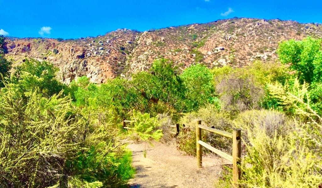
Although the park sits only eight miles from downtown San Diego, it persists in a world of its own. Trail lengths stretch from less than a mile to six or seven miles and can be tailored to any adventure style and time. Maps are available online, through the AllTrails app, and at the Visitor’s Center, which is currently closed due to Covid restrictions. Just outside the Center is a short, mostly flat loop where new hikers can become accustomed to the environment before attempting any steep climbs if needed. Download this map before you go!
Best Time to Go
Mission Trails represents the natural semi-arid terrain of southern California and provides very little shade. As such, hikes are better undertaken in the early mornings and during the winter season. The park is popular and open year-round, thanks to San Diego’s climate.
Trails open at 8 am, although there are no restrictions at any trailheads, so many visitors start hiking at dawn. When attempting the Challenge, starting earlier is the best way to ensure success. Fall and winter are great seasons to go, but the best season for hiking in San Diego is spring. Summer can get really hot, so definitely check the weather forecast and start your hike early to avoid the heat.
What to bring
Other necessities include good shoes (hiking shoes recommended), sunblock, sunglasses, hats, maps, and plenty of water (a camelback is nice). On longer hikes, snacks are highly recommended, especially as an excuse to rest at the top of a peak or to fuel the next summit attempt.
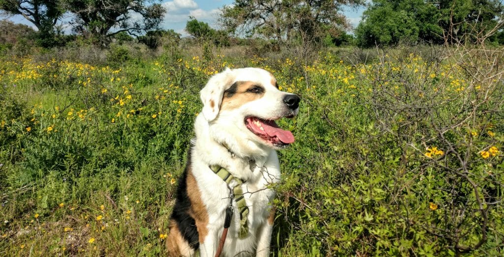
Can I Bring My Dog?
Dogs are welcome on the trail, but all users ask they are properly cared for during their stays. Definitely bring enough water for your dog and if temperatures are expected to be hotter than 75-78 F during your hike, leave your pooch at home.
Wildlife
Wildlife abounds within Mission Trails, particularly birds, rabbits, and lizards, with the occasional rattlesnake, tick, and poison oak patch to keep things interesting. However, due to the popularity of the park—hikers will very rarely find themselves alone—so safety concerns are minimal.
Meet The Five Peaks
The five peaks of Mission Valley present unique challenges and benefits, despite their seeming similarities. Below is a proposed order for completion of either the one-day or multi-day challenge, although each peak can be attempted in any order, of course.
South Fortuna Mountain
The shortest of the peaks, South Fortuna reaches only 1,094 feet above sea level. Despite that, it has one of the steepest approaches in Mission Trails. Its southern face sports a series of steps known colloquially as the Stairmaster, which can break even seasoned hikers, and turns legs to jelly on the descent. This exhausting approach does present great views of the valleys around, however, including some impressive granite cliff faces to the south.
Two main staging areas for the Fortuna Mountains exist. The first is near the Visitor’s Center, where hikers must cross the San Diego River. This can prove difficult after heavy rains, so care must be taken during our brief wet season. The other area is conveniently called the Fortuna Staging Area, located on the western edge of the park. This trail crosses a wooden bridge before looping around to the South Fortuna Stairs. While longer, it avoids the river crossing.
At the summit, South Fortuna offers stunning views of central San Diego and Mission Valley. From there, visitors can take the saddleback to North Fortuna, an easy route with a smaller viewpoint in its center, or brave the stairs back to the staging area. Proceeding to North Fortuna, then down its north face to circle back to parking lots, provides one of the few looping trails in the park, and conveniently links the two peaks on one hike. This loop can also be done in reverse, hitting North Fortuna first, to avoid the stairs to the South peak.

North Fortuna Mountain
North Fortuna was originally the only Fortuna Mountain until surveyors separated the South Peak from it. The two peaks sit in a valley with steep slopes to the east and west, cutting them off from the urban noise surrounding the park. The natural views are spectacular, helping visitors forget they are only minutes from the city center.
This valley network presents dozens of overlapping trails that wind around both peaks, with the San Diego River and its crossing at its base. Some trails are limited to hiking, while others support mountain bike trails. As such, there are numerous paths to reach the mountains, and covering them all is beyond the scope of this discussion. There is also considerable construction ongoing in this area due to a new pipeline through the park, so some trails are closed. Specific updates are posted at trailheads and online.

North Fortuna itself maintains both a north and south approach, like most of the other peaks. The south approach is the Fortuna Saddleback between it and South Fortuna, making it the gentler of the two approaches. This portion gently undulates, giving breathing space to tired climbers.
The north approach is reached by circling through the valley to the back of the mountain, almost to the 52 freeway. The noise from the freeway distracts from the natural surroundings, sadly, but does not wreck the beauty of the valleys at this end of the park. The final approach on this end is quite steep—particularly near the top—and can force hikers to rest often, but the view from the top is impeccable. The best sights are north and west, overlooking a broad swath of North County all the way to the Pacific.
Kwaay Paay Mountain
Relatively isolated, Kwaay Paay sits between the Cowles/Pyles system and the two Fortuna Mountains. It features trails from the north and south, both of which are up-and-back routes, that are significantly steeper than most of the other trails in the park. The north approach is the shorter and more popular of the two, and begins approximately where the Old Mission Dam sits. This historic dam provided water to the Friars of early San Diego, and is well worth a stop. It even has picnic tables to enjoy before or after the summit attempt.

This peak provides the best views of the San Diego River as it winds down into Mission Valley. The trails here are relatively quiet, though heavily trafficked at certain times. Its trails are the shortest of the five mountains, making a climb much faster.
Cowles Mountain
By far the most popular peak in the park, Cowles Mountain is the highest peak in San Diego at 1,592 feet. The peak is best attempted early in the morning and, if possible, on weekdays, because of the crowds. It suffers the most from overuse and contains the most garbage and abandoned dog waste of all trails combined. Due to its height, however, it offers some of the best views in the park and a great spot to watch an epic San Diego sunset. On a clear day, hikers can see everything from Miramar Airport and the UTC to downtown San Diego, Point Loma, and even into Mexico.
The southern approach—from the Cowles Mountain Staging Area—is well-maintained, with railings along most of its course and switchbacks that soften the height increase. It quickly becomes overcrowded any day of the week, but is still a good trail. Sometimes better is the eastern approach from Big Rock Park, which gently rises to the peak along its eastern front. This trail is longer, but much quieter. Both approaches are fairly easy aside from the final peak approach, which can take the wind out of anyone.
Pyles Mountain
The forgotten, overlooked mountain of the bunch, Pyles is easily my favorite peak in the system. It cannot be reached on its own, but instead, through a saddleback, it shares with Cowles Mountain. Very few hikers proceed to it after climbing Cowles, making it the quietest, most serene mountain in the park. Its isolation created a further benefit: It maintains perhaps the least-disturbed chaparral environment within the county, and more wildlife calls this trail home than any other. Particularly after the crowds on the Cowles trails, this trail relaxes the mind and body beautifully. The view at the end, overlooking Murray Lake, is likewise impressive.
In addition, with no direct route back to ground level, the trail is relatively flat after the climb up to Cowles. That makes it a restful meander compared to the other climbs, as well as a convenient way to attain two peaks in one attempt.
The Five Peak One-Day Challenge
There are two ways to approach the one-day five peak challenge. The first is by completing each mountain individually and driving between trailheads, as portrayed above. This option results in multiple shorter hikes totaling about fourteen miles, with longer rests between each peak to make this a more accessible option. Mission Trails offers maps of suggested routes for tackling each peak, most of which are discussed above, and can be found both online and in the AllTrails app.

The alternative: Attack all peaks in one lengthy hike, and then get a ride back to the staging area (there is no convenient way to loop all five peaks). The primary route is the one suggested in the book “Afoot and Afield—San Diego,” the bible of San Diego hiking. Highly recommended for all San Diegans, this book provides detailed maps and information on routes throughout the county.
The trail runs 16.4 miles with an elevation gain of over 4,400 feet and represents the path I most want to try. It begins with South Fortuna and North Fortuna, on to Kwaay Paay, then through a nearby neighborhood, before summiting Cowles and Pyles. While the book suggests tracing the trail in that order, it can be followed in the reverse as well, with pros and cons to each. Clockwise softens slopes on either side of the Fortuna Mountains, but it pushes hikers up the South Fortuna ‘Stairmaster’ and ends at a very busy time on the Cowles descent.

The Five Peak Challenge at San Diego’s Mission Trails Regional Park represents one of the greatest hiking opportunities in the San Diego area. The trails are beautiful, with impressive views for miles in all directions. Whether attempting the entire task at once, each peak individually, or even just enjoying the easier, flatter trails surrounding the mountains, the park is not to be missed. Locals sometimes take the place for granted, but it never disappoints those who visit.
Last Updated on July 26, 2023 by Maria Haase
 San Diego in April: Weather & Best Things To Do
Is the 5 peak challenge still going to receive a certificate of completion.
Unfortunately, the official challenge has ended, as explained in the article but it is still a very popular bucket list item for local hikers, and many complete the challenge each year.